TL;DR: The Ring of Kerry is a 179km scenic driving route around the Iveragh Peninsula featuring historic landmarks, coastal scenery, and the Skellig Ring. For an optimal experience, travellers are advised to drive clockwise to avoid tour buses and dedicate at least one full day to exploring its diverse highlights and local villages.
The Ring of Kerry is one of Ireland’s most famous driving routes, covering 179km (111 miles) of coastal and mountain scenery in County Kerry. This circular Ring of Kerry route takes you around the Iveragh Peninsula, passing through historic towns, ancient archaeological sites, and the Atlantic coastline. While many visitors try to see everything in a single day, the best way to experience the Ring of Kerry drive is at a slower pace that allows for stops at local villages and viewpoints.
This guide provides practical information for planning your journey, including the best stops on the Ring of Kerry, the ideal time of year to visit, and essential tips for driving the Ring of Kerry. Whether you are driving yourself or joining a small group tour, understanding the layout of the peninsula will help we make the most of your time in the southwest of Ireland.
Table of Contents
- The Ring of Kerry: A Brief Overview
- What is the Ring of Kerry?
- What are the Best Stops on the Ring of Kerry?
- When is the Best Time to Visit the Ring of Kerry?
- Key Information for Visiting the Ring of Kerry
- Is the Ring of Kerry Worth the Trip?
- FAQs
The Ring of Kerry: A Brief Overview
The Ring of Kerry offers an unparalleled journey through Ireland’s natural heritage and rugged coastal beauty. Here is a foundational understanding of the route’s geography and logistics before exploring the highlights.
| Feature | Detail |
| Total Distance | 179 km (111 miles) |
| Route Shape | Circular loop around the Iveragh Peninsula |
| Starting Point | Usually Killarney, but also Kenmare or Killorglin |
| Driving Time | 3.5 hours (non-stop) / 7+ hours (with stops) |
| Recommended Direction | Clockwise for cars (to avoid tour bus traffic) |
| Key Stops | Killarney National Park, Kenmare, Sneem, Derrynane, Portmagee |
| Highlight Landscape | Atlantic coast, MacGillycuddy’s Reeks, and the National Park |
| Best Time to Visit | May, June, or September |
| Best For | Cultural history, coastal scenery, and photography |
What is the Ring of Kerry?
The Ring of Kerry is a scenic circuit located in the southwest of Ireland. It forms a significant section of the Wild Atlantic Way, circumnavigating the Iveragh Peninsula.
If you are wondering how far the Ring of Kerry is, the loop is approximately 179km long, primarily following the N70 road to connect a series of coastal towns and inland mountain passes.
- Location: County Kerry, beginning and ending in the Killarney area.
- Significance: The area contains Ireland’s highest mountain range, the MacGillycuddy’s Reeks, and several well-preserved stone forts.
- The Route: The drive moves through varied terrain, including the rugged coastline of the Atlantic and the protected woodlands of Killarney National Park.
For those wondering how long the Ring of Kerry is in terms of time, we recommend dedicating at least a full day to allow for the many Ring of Kerry highlights. For those traveling from other hubs, we often incorporate these roads into our tours from Dublin or our specialized itineraries for those arriving on tours from Belfast.
What are the Best Stops on the Ring of Kerry?
Identifying the best stops on the Ring of Kerry depends on your interests, but the route offers a consistent mix of natural beauty and historical sites. Here are the primary locations to include in your Ring of Kerry itinerary.
Killarney National Park
This is often the starting or ending point of a Ring of Kerry road trip. It features the Lakes of Killarney and historic landmarks like Muckross House and Ross Castle.
- Fun Fact: As Ireland’s first National Park, it protects 10,000 hectares of oak and yew woodlands alongside the MacGillycuddy’s Reeks.
- Key Highlight: Torc Waterfall is reached via a flat, 200-metre path from the car park, making it one of the most accessible natural sites on the route.
The park is also home to the only remaining wild herd of native Red Deer in Ireland, which has lived in the area since the last Ice Age. To experience the park at a slower pace, many visitors choose to take a traditional horse-drawn jaunting car through the wooded paths and lakeside trails.
Kenmare
Kenmare is a colorful heritage town known for its culinary scene and local artisan shops. It serves as a quieter alternative to Killarney for those staying overnight.
Kenmare is also an ideal gateway for exploring the neighboring Beara Peninsula. Many travelers prefer the relaxed pace here as a base for a Ring of Kerry road trip due to its smaller, walkable layout and abundance of independent craft shops.
- Fun Fact: The town was founded in 1670 and features a unique triangular street layout.
- Key Highlight: The Kenmare Stone Circle is one of the largest in Southwest Ireland and is located just a short walk from the town center.
Sneem Village
Sneem is famous for its bright, multi-colored houses and peaceful atmosphere. It is a great place to stop for a coffee or to walk through the local sculpture park.
- Fun Fact: The village is divided into two squares, North and South, by a narrow bridge over the Sneem River.
- Key Highlight: The “Way of the Greeks” sculpture park offers a quiet place for a stroll away from the vehicle traffic.
The village is often referred to as the “The Knot in the Ring” because of its central location on the peninsula. It is a popular spot for visitors to pause and enjoy the riverside views or visit the local “Garden of the Senses” which features a range of native Irish plants.
Derrynane House and Beach
This was the ancestral home of Daniel O’Connell, a significant figure in Irish history. The surrounding parkland leads directly to one of the most beautiful beaches in the country.
- Fun Fact: The house is now a museum, and the surrounding 320-acre National Historic Park is free to explore.
- Key Highlight: Take the coastal path for views of Abbey Island and the surrounding turquoise waters.
During low tide, visitors can walk across the sandbar to explore the ruins of an 8th-century monastery on Abbey Island. The beach itself is a Blue Flag destination, noted for its clean water and soft sand, making it a perfect spot for a coastal walk.
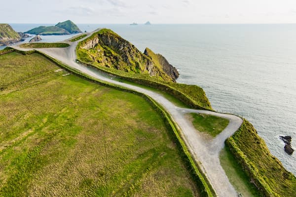
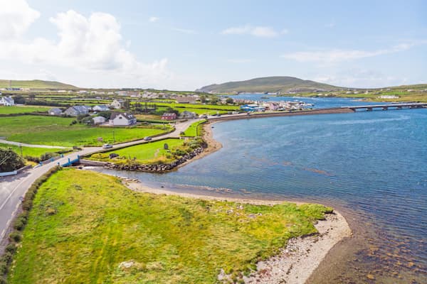
Portmagee and the Skellig Ring
While technically a detour from the main N70, Portmagee is the gateway to the Skellig Ring. This section is often considered the most scenic part of the entire Ring of Kerry drive.
- Fun Fact: Large tour buses are physically unable to navigate the Skellig Ring, making it much quieter for cars and small group tours.
- Key Highlight: The Kerry Cliffs offer a 1,000-foot drop into the Atlantic and provide a clear view of the Skellig Islands on a fine day.
Portmagee is a working fishing village where you can see local boats bringing in the daily catch of shellfish and whitefish. The Skellig Experience Centre, located just across the bridge on Valentia Island, provides deep insights into the lives of the monks who once lived on the remote Skellig Michael.
When is the Best Time to Visit the Ring of Kerry?
The best time to visit the Ring of Kerry is generally during the “shoulder” months of May, June, and September. During these periods, the weather is typically stable, and the heavy crowds of mid-summer have not yet arrived.
Spring (March – May)
Spring in Ireland sees the landscape turning vibrant green, and the local wildflowers begin to bloom. It is a quieter time for driving the Ring of Kerry before the peak tourist season.
- Temps: Average highs of 10°C – 15°C and lows of 4°C – 7°C.
- Weather: Expect a mix of bright sunshine and passing Atlantic showers.
- Daylight: Daylight increases from 11 hours in early March to over 15 hours by late May, providing ample time for stops.
- Traffic: Roads are relatively quiet, which helps reduce the stress of navigating the peninsula for nervous drivers.
Villages like Sneem and Waterville feel fresh and welcoming, with local gardens in full bloom and a peaceful pace to daily life.
Summer (June – August)
Summer in Ireland offers the warmest weather and the longest days, but it is also the busiest time of year. If you visit in summer, expect more traffic and busier Ring of Kerry stops.
- Temps: Average highs of 17°C – 20°C and lows of 10°C – 12°C.
- Weather: Typically the driest period, though humidity is high and rain is always a possibility.
- Daylight: These months offer the longest days, with up to 17 hours of light in June to explore the Ring of Kerry highlights.
- Traffic: Traffic is at its peak; we recommend starting your Ring of Kerry drive before 9:00 AM to stay ahead of the large coach groups.
Towns like Killarney and Kenmare are at their liveliest, with plenty of evening music and outdoor dining.
Autumn (September – November)
Autumn in Ireland, particularly September, is often considered the best time of year to visit the Ring of Kerry. The crowds thin out significantly, but the weather often remains mild.
- Temps: Average highs of 14°C – 16°C and lows of 8°C – 10°C.
- Weather: Changeable conditions with more frequent wind and rain as November approaches.
- Daylight: Hours decrease from 13 in September to about 9 in November, which may require a more focused Ring of Kerry itinerary.
- Traffic: Road congestion drops significantly, allowing for a more relaxed Ring of Kerry road trip with easier parking at major viewpoints.
The hills begin to turn shades of gold and rust, offering excellent opportunities for photography and a different perspective on the landscape.
Winter (December – February)
Winter in Ireland is the quietest season, and while some local attractions may have shorter hours, you will have the Ring of Kerry highlights almost to yourself.
- Temps: Average highs of 7°C – 9°C and lows of 2°C – 4°C.
- Weather: Often wet, windy, and moody with dramatic Atlantic skies.
- Daylight: Daylight is limited, with the sun setting as early as 4:30 PM in December, resulting in roughly 8 hours of light.
- Traffic: Traffic is virtually non-existent, though some smaller businesses along the Ring of Kerry route may close for the season.
The mountains are often capped with mist or snow, providing a very different, rugged feel to the peninsula for those who prefer solitude.
Key Information for Visiting the Ring of Kerry
Planning your Ring of Kerry drive requires a bit of practical knowledge to ensure the trip is comfortable and safe. Here are the essential details to keep in mind.
- Fueling Up: Gas stations are located in the main towns like Killarney, Killorglin, Cahersiveen, Waterville, and Kenmare. We recommend filling up your vehicle whenever you have the opportunity, as there are long stretches of rural road between these hubs where fuel may not be available.
- Mobile Signal: Signal can be intermittent on the more remote coastal stretches and mountain passes like Moll’s Gap. We suggest downloading offline maps or using a physical guidebook for navigation.
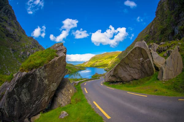
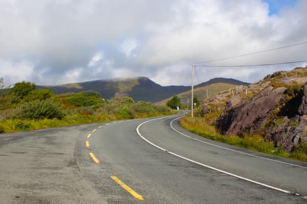
- Road Conditions: The N70 is the primary road for the Ring of Kerry route. It is a paved, two-lane road, but it can be narrow in places with sharp bends, so a relaxed speed is necessary.
- Public Toilets: Facilities are generally found in the main villages or at major heritage sites like Derrynane House. Many local cafes also provide facilities for paying customers.
- Tour Bus Traffic: All large tour buses are required by local regulations to travel in an anticlockwise direction. To avoid being stuck behind them, most car drivers choose to travel in a clockwise direction.
Is the Ring of Kerry Worth the Trip?
Are you wondering if the Ring of Kerry should be part of your Irish adventure? While the drive is long, the combination of coastal views, historic sites, and local hospitality makes it one of the most rewarding experiences in Ireland.
To enjoy the route without the stress of navigating narrow roads, consider joining one of our small group tours. We handle the driving so you can focus on the stories and scenery of the Iveragh Peninsula.
FAQs
What is the Skellig Ring, and should I drive it?
The Skellig Ring is a scenic 18km extension of the main Ring of Kerry route that begins in Portmagee. It is highly recommended because large tour coaches cannot fit on its narrow roads, offering a much quieter experience with some of the best views of Skellig Michael and the Valentia Island lighthouse.
How many hours does the Ring of Kerry take?
If you drive without stopping, the loop takes about 3.5 hours, but a meaningful trip with stops at the best stops on the Ring of Kerry takes 7 to 9 hours. We recommend leaving early in the morning to allow plenty of time for walks and lunch without feeling rushed.
Is it difficult to drive the Ring of Kerry?
The roads are well-maintained but can be narrow and winding in certain sections, especially on the coastal cliffs. If you are comfortable driving on the left and managing narrow passing points, the drive is manageable for most confident drivers.
Are there entrance fees for the Ring of Kerry highlights?
Most of the natural scenery, including the beaches and Killarney National Park, is free to access. Some specific sites, like Muckross House, the Kerry Cliffs, or the Skellig Experience Centre, do require a small entry fee for maintenance and preservation.
What do the “WAW” signs along the route mean?
The “WAW” signs stand for the Wild Atlantic Way, Ireland’s coastal touring route. Along the Ring of Kerry, you will see blue signs with a zig-zag wave symbol; “N” points North (anticlockwise toward Galway) and “S” points South (clockwise toward Kenmare), helping you navigate the peninsula without needing a constant GPS signal.
Got more questions about visiting Ireland? Check out our main FAQs page for answers, tips, and advice about visiting Ireland.